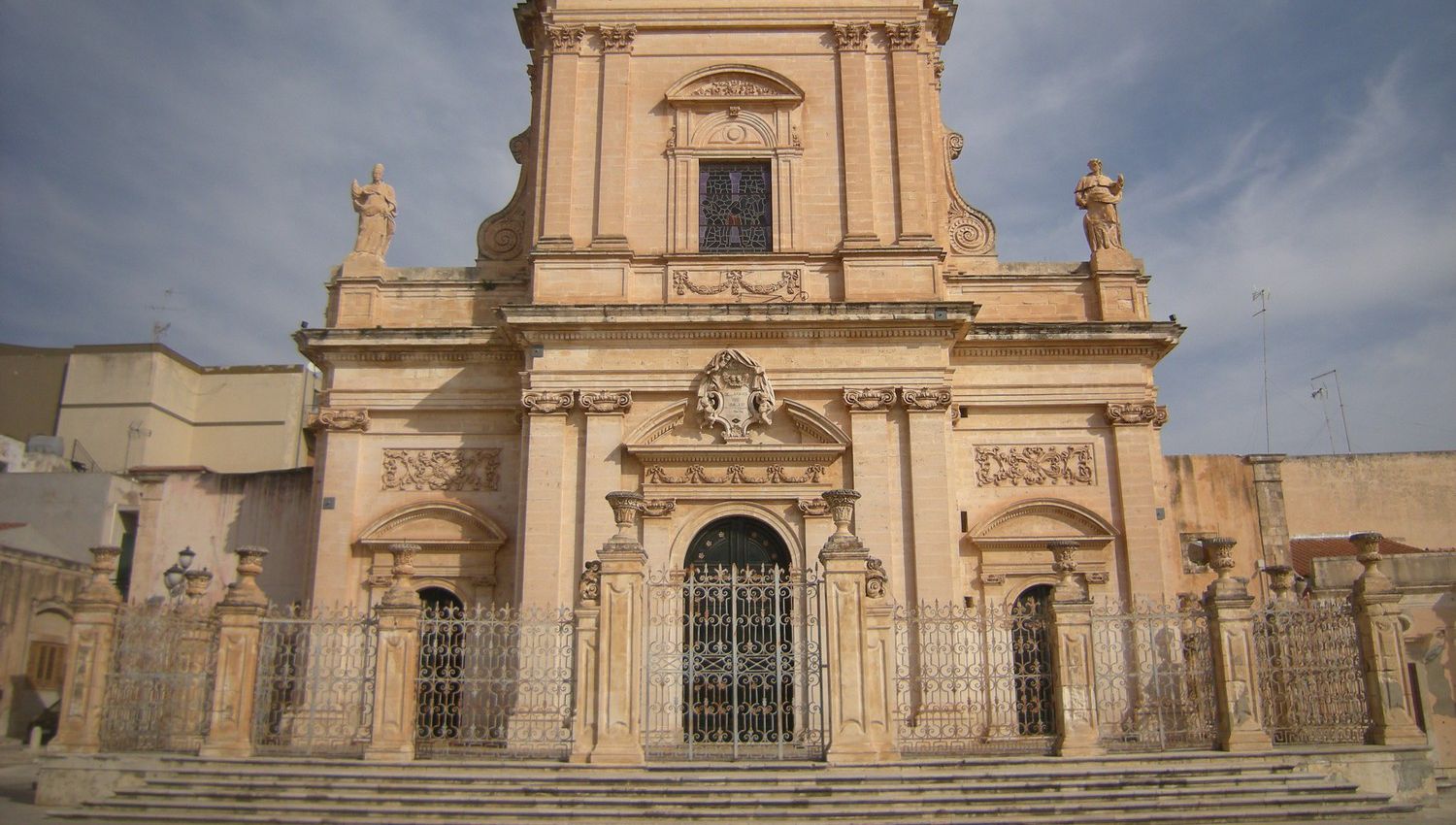
The town of Ispica
The municipality of Ispica is located in the south-eastern part of the province of Ragusa and borders the territories of the municipalities of Modica and Pozzallo to the north and west, while, with the municipalities of Pachino, Rosolini and Noto to the south and east. The city is located on the Calandra hill at 170 m above sea level. There are numerous sites of archaeological interest, including the Archaeological Park of the Forza and Cava d’Ispica. The city has an eighteenth-century area and a medieval area adjacent to a cliff where the ruins of the fortress (fortilitium) and the ancient city of Spaccaforno are located. There are numerous and important ecclesiastical and civil architectures present. Thanks to its splendid characteristics, Ispica aspires to be part of the late Baroque cities of the Val di Noto; in fact, the inclusion among the Heritage of Humanity by UNESCO is in progress. The municipal area is crossed by two main river courses, the Ispica quarry and the Busaitone river, often dry. Its coast extends between the municipality of Pozzallo and the municipality of Pachino (Syracuse), for about 13 km in length, first with low and sandy stretches and then high and rocky. The “Punta Ciriga” located in the municipal area marks the southernmost point of the province of Ragusa.
Moreover, as evidenced by archaeological findings, the area was already occupied in the late Roman period. In Roman times, the city was given the name of Hyspica e fundusa which was then changed to Spaccaforno until 1934. The territory was dominated by the Sicilians, the Greeks, then the Romans and Byzantines. Between the ninth and eleventh centuries A.D. there was Arab domination. The Saracen government ended with the Norman conquest by the Great Count Ruggero, and the first official document that mentions the city with the name of Isbacha dates back to 1093. Ispica was subsequently governed by the Swabians and Angevins, and at the beginning of the 14th century . by the viceconte Berengario of Monterosso who in turn donated it to Queen Eleonora d’Angiò, wife of King Frederick III, therefore, it was granted as a fief to Francesco Perfoglio in 1375. The municipal territory followed the events of the county of Modica, to which merged to be entrusted to Francesco II Statella and the heirs who governed it until the abolition of feudality in the nineteenth century. On 11 January 1693 the city of Spaccaforno was hit by a catastrophic earthquake that destroyed the entire town that previously extended mostly within the Cava d’Ispica. After the earthquake the city was refounded in the flat area and therefore outside the quarry. Some neighborhoods were instead rebuilt around the damaged churches that still remained standing, such as Sant’Antonio and the Chiesa del Carmine, while the other city neighborhoods were built from scratch. In this period were built the magnificent baroque churches of Santa Maria Maggiore, the church of San Bartolomeo and the church of SS. Annunziata. In 1812 the city was incorporated into the district of Modica and the province of Syracuse, from where in 1927 it passed to the new province of Ragusa. In 1935 the name of Spaccaforno was changed to Ispica with a Royal Decree. Cava Ispica is the most important of the “quarries” in eastern Sicily. 13 km long, it extends over the territory of the municipalities of Modica, Ispica itself and Rosolini. There are a series of cave dwellings and it was inhabited from prehistoric times to the nineteenth century. There are several archaeological sites in the area: the catacombs of San Marco, the necropolis of c.da Crocefia. An important naturalistic site are the Bruno and Longarini marshes which are located at the southern end of the municipal area and are brackish water lakes separated from the sea only by sand dunes. They are habitats for the Mediterranean scrub and host the stop of migrating birds, such as moorhens and mallards and others. According to the seasons it is possible to observe the turkish fiscione, forapaglie, herons, storks and flamingos, etc.

